Whether you are a seasoned sailor or an avid angler, having accurate navigation tools can make all the difference in your experience on the water. Chart Viewer Navionics is a powerful digital charting tool that provides essential marine data, making it a favorite among boaters, sailors, and fishermen. It offers real-time updates, depth contours, and interactive maps to enhance safety and efficiency while on the water.
In this guide, we’ll explore the benefits of using Navionics Chart Viewer for both fishing and sailing, helping you understand why it has become a go-to tool for marine navigation.
How Navionics Chart Viewer Enhances Marine Navigation
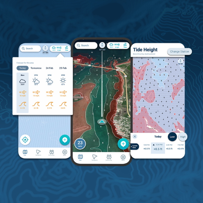
Navionics Chart Viewer is an online tool that provides access to detailed marine charts, navigational markers, and depth readings. Unlike traditional paper charts, this tool allows users to interact with maps, customize routes, and access real-time updates. Whether you are planning a sailing trip or scouting the best fishing spots, Navionics Chart Viewer provides crucial data to improve your experience on the water.
Some of its standout features include:
- Depth contours and bottom composition for safer navigation.
- Tidal and current information to help plan efficient routes.
- SonarChart Live updates that improve accuracy with user-generated data.
- Detailed mapping of fishing hotspots based on historical and real-time data.
Benefits of Navionics Chart Viewer for Fishing
1. Accurate Depth Contours for Finding Fish
One of the most valuable features for anglers is detailed depth contours. Fish tend to gather around specific depths and underwater structures such as drop-offs, reefs, and ledges. Navionics Chart Viewer provides precise bathymetric data, helping anglers locate the most promising fishing areas.
2. SonarChart Live for Real-Time Data
Navionics Chart Viewer offers SonarChart Live, which allows users to upload their sonar recordings to enhance accuracy. This feature is particularly useful for fishermen who want real-time depth adjustments based on actual water conditions. By refining depth data, anglers can locate optimal fishing spots more effectively.
3. Tidal and Current Information
Fishing success often depends on tide movements and currents, which influence fish behavior. Navionics provides detailed tidal and current forecasts, allowing anglers to plan their trips based on the best conditions for their target species. By knowing when and where the water is moving, fishermen can increase their chances of a productive day.
4. Mapping the Best Fishing Spots
Navionics Chart Viewer allows anglers to save and mark fishing hotspots, creating a personal fishing map. Users can mark waypoints for productive fishing zones, making it easier to return to the same locations in the future.
5. Weather and Marine Forecasts
Safe fishing depends on weather conditions, and Navionics offers access to marine weather forecasts. By integrating real-time wind, wave, and weather updates, anglers can make informed decisions before heading out on the water.
Benefits of Navionics Chart Viewer for Sailing
1. Safe Route Planning with Accurate Charts
For sailors, precise nautical charts are crucial for safe navigation. Navionics provides highly detailed marine maps, helping sailors avoid hazards, sandbanks, and shallow areas. Users can plot safe and efficient sailing routes, reducing the risk of unexpected obstacles.
2. Real-Time GPS Tracking
Navionics Chart Viewer integrates with GPS tracking, allowing sailors to see their live position on the chart. This is essential for long voyages, where real-time location tracking helps maintain safe and strategic navigation.
3. Tidal and Wind Forecasts for Efficient Sailing
Wind and tide conditions play a significant role in sailing efficiency. Navionics provides detailed wind and tide information, allowing sailors to plan routes that take advantage of favorable wind patterns and current movements.
4. Navigational Aids and Alerts
Navionics includes navigational markers, buoys, and hazard alerts, helping sailors avoid dangerous areas. This feature is particularly useful in unfamiliar waters where hidden rocks or shifting sandbanks can pose risks.
5. Integration with Other Marine Devices
Navionics Chart Viewer can be used alongside chart plotters, GPS devices, and sonar systems, providing a seamless navigation experience. This integration makes it easier for sailors to combine data from multiple sources for more precise route planning.
How Navionics Chart Viewer Compares to Other Marine Navigation Tools
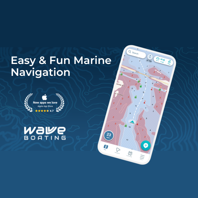
While Navionics is a top-tier tool, some other marine navigation options include:
- C-MAP – Offers similar charting capabilities but lacks the same level of user-generated sonar updates.
- NOAA Charts – Free for U.S. waters but less interactive and lacks real-time updates.
- Garmin BlueChart – Provides advanced GPS tracking, but primarily for Garmin device users.
Navionics stands out due to its user-friendly interface, frequent updates, and depth contour accuracy, making it ideal for both fishing and sailing.
Best Practices for Using Navionics Chart Viewer
To maximize the effectiveness of Chart Viewer Navionics, follow these best practices:
- Always update your charts – Ensure that your maps have the latest data for accuracy.
- Use GPS alongside Navionics – Combine GPS navigation with Navionics for real-time tracking.
- Check tide and weather conditions – Plan your trips based on safe and favorable conditions.
- Utilize SonarChart Live – Enhance accuracy by contributing sonar data from your own trips.
- Mark important locations – Save fishing hotspots, marina locations, and safe anchor points.
Final Thoughts: Is Navionics Chart Viewer Worth It?
For both fishing and sailing, Navionics Chart Viewer is an invaluable tool that offers detailed charts, real-time updates, and essential marine data. Anglers benefit from depth contours, tide forecasts, and sonar mapping, while sailors enjoy accurate navigation, GPS tracking, and weather integration.
With its easy accessibility, frequent updates, and powerful features, Navionics Chart Viewer is a must-have for anyone spending time on the water. Whether you’re fishing for the perfect catch or navigating unfamiliar coastlines, this tool enhances safety, efficiency, and overall enjoyment on every trip.
